What is the purpose of the study?
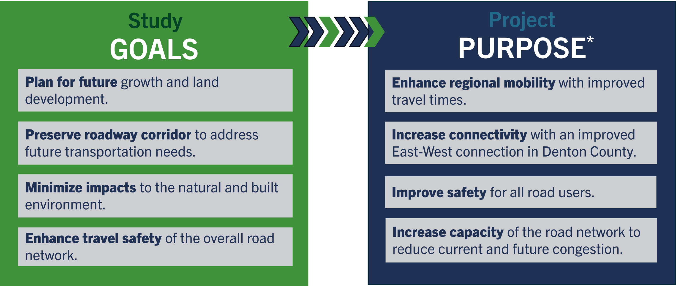
- Plan for future growth. Substantial growth is projected in the study area and across Denton County. With a population of 1.07 million people in 2025, Denton County is projected to grow to 1.88 million people by 2050, according to North Central Texas Council of Governments (NCTCOG) demographic forecasts for the region. That's an approximately 76% increase in population.
- Enhance regional mobility. The existing roadway network in the study area consists of small rural county roads and Farm-to-Market roads. These roadways were not designed to handle the expected traffic growth and increasing congestion is hampering travel times. As growth and development continue to move north and east in the County, another high-capacity east-west corridor, other than US 380, will be needed.
- Preserve land needed for a future corridor. The study area includes many constraints from residences and ranches to public lands and rivers. Our study team is working to avoid and minimize, as feasible, impacts to homes, businesses and environmentally sensitive areas. However, given the rapid growth and development that is expected, the County must act now to establish the alignment, get it environmentally cleared, and then preserve the land needed for the corridor to protect it from future development.
Click here to view the project's formal Purpose & Need statement developed as part of the environmental study process.
What is the study process?
The County is required to assess the environmental effects of the project prior to making any decisions and the process must adhere to the National Environmental Policy Act (NEPA). The county must obtain environmental clearance for the project in order to use federal funds to construct the roadway. This is anticipated to be a three-to-five-year process.
National Environmental Policy Act (NEPA)
Following NEPA requirements, the County plans to prepare an Environmental Impact Statement (EIS). The County will identify and study several possible alignments to try to identify the one that is the least impactful. These options will be presented to the public for consideration.
Once the most reasonable and feasible alignments are identified, Denton County is required to complete more in-depth traffic and travel demand analysis, and to complete an environmental study which includes in-person field assessments and surveys in areas where landowners have agreed to allow access. The purpose of the assessments is to determine locations of resources such as wetlands, floodplains, and culturally sensitive areas.
Schematic Design
During this EIS, Denton County will develop the schematic design which means that the following tasks will be completed:
- Determine number of lanes
- Develop ramp location and interchange configurations
- Determine the amount of land (also called right of way) needed to construct the project
- Complete a drainage design
- Consider bicycle and pedestrian accommodations
- Calculate more detailed cost estimates
Evaluating Environmental Impacts
Included in EIS development is a federally required evaluation of potential environmental impacts. The identified alignments and design will be studied to determine impacts to air quality, archeological resources, biological resources, community assets, property, hazardous materials, historic resources, protected lands (parks), traffic noise and water resources, among other considerations.
Public Involvement
Denton County will also provide opportunities for public involvement and will coordinate with resource agencies, municipalities, and major utility providers. The study team will be hosting multiple meetings (both in-person and virtual) for the public to provide input to the planning process, as well as reaching out to property owners in the study area.
Study Schedule