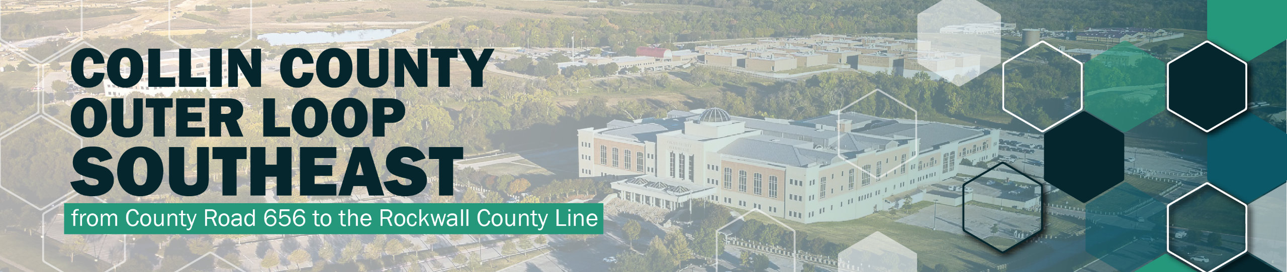
ABOUT THE PROJECT
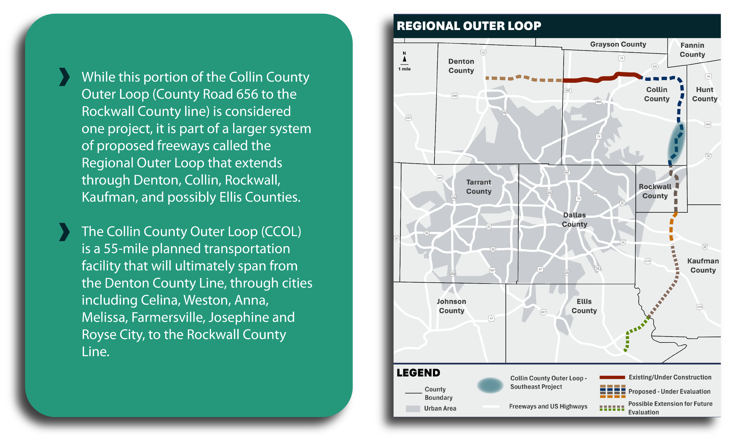
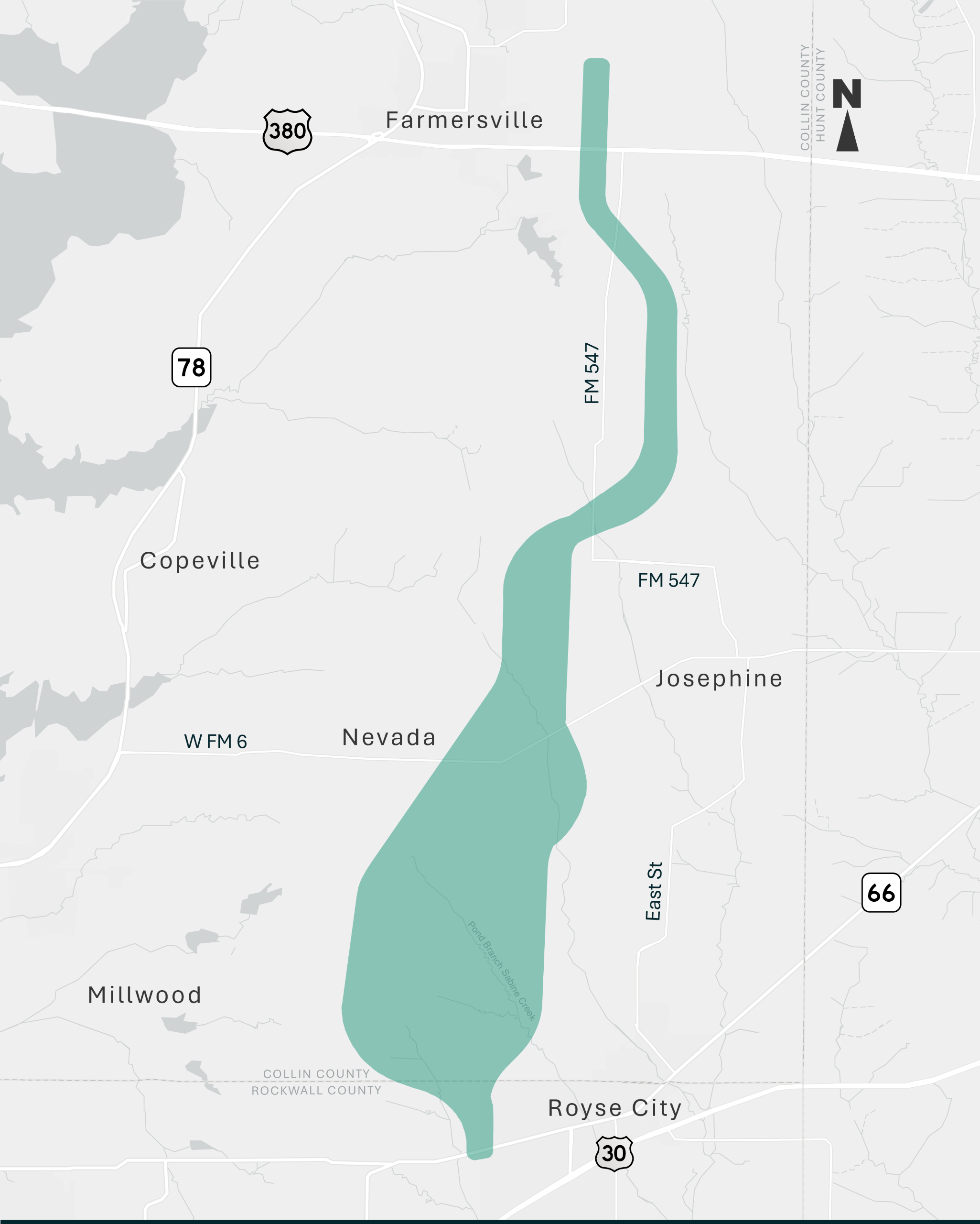
Collin County is conducting a study to finalize the alignment of a segment of the Collin County Outer Loop that extends approximately 14 miles from County Road 656 in Farmersville to the Rockwall County Line in southeast Collin County. This roadway is ultimately intended to be a new location freeway with a 500ft. right-of-way that would be constructed in phases over time as the need grows.
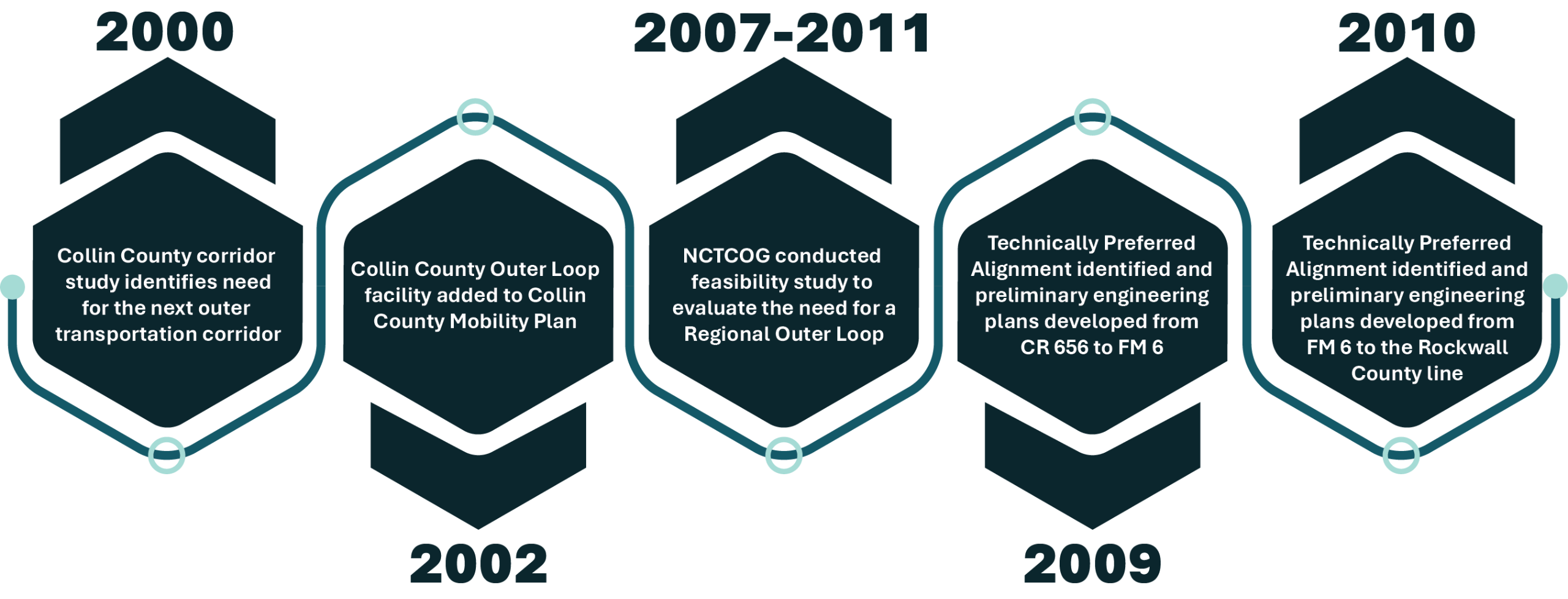
The project began in mid-2024 and Collin County is now in the process of gathering data, meeting with stakeholders, refining the 2009-2010 previous Technically Preferred Alignment, and developing a Local Environmental Document.
To stay in the loop and be notified of upcoming meetings, subscribe to stay informed on the right.

To view the updated alignments under evaluation, please visit the Resources page to view previous public meeting information.

Project Purpose
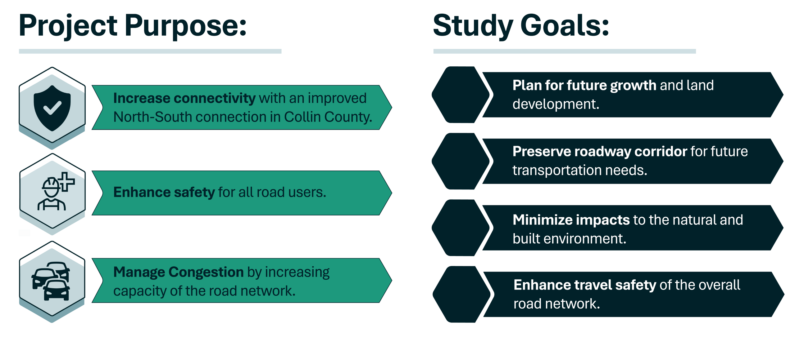
- Plan for future growth. The Collin County Outer Loop is being studied in response to rapid population growth anticipated in the county over the coming decades, which will require better roads with greater connectivity. Already one of the fastest-growing counties in the nation, Collin County had a population of just over 1.1 million in 2020. By 2050, the population is projected to double, surpassing 2.1 million. At the time of ultimate buildout, when the county is fully developed, it is expected to exceed 3 million people. To support this growth and improve regional connectivity, major transportation upgrades are needed.
- Preserve roadway corridor. To protect the future Outer Loop corridor from development, the County plans to secure the right-of-way in the first phase of construction. By preserving the right-of-way required for the entire project, the County can safeguard the project’s right-of-way footprint from future development.
- Minimize Impacts. Since the previous Technically Preferred Alignment (PTPA) was identified in 2009/2010, development in the project area has significantly increased. Between 2021 and early 2024, over 10,000 acres in southeast Collin County have been identified as newly developed or planned for development. The study team is identifying areas where the PTPA can be modified based on new constraints in the project area.
- Enhance travel safety. Between 2015 and 2023, daily traffic volumes have more than doubled on some Farm-to-Market roadways in southeast Collin County. As traffic volumes grow, the existing and proposed roadway network will experience additional congestion, contributing to an increase in the number and severity of crashes. Between 2016 and 2024, there was a 69 percent increase in crashes that resulted in an injury or fatality across the project area.
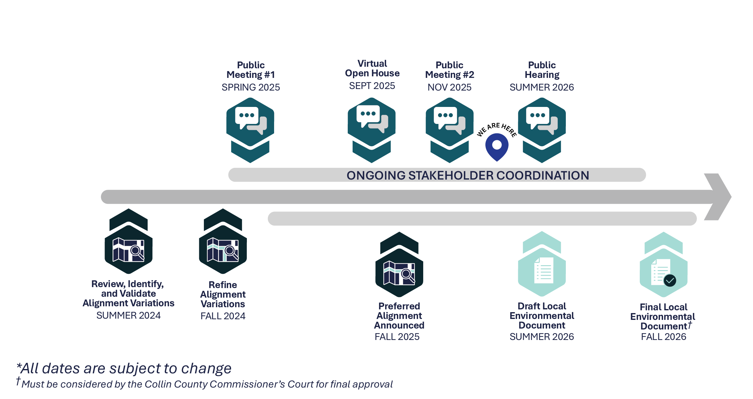
PROJECT TIMELINE
BACKGROUND